File:MAP L85c no.29 part 1.jpg

Size of this preview: 800 × 393 pixels. Other resolution: 1,536 × 755 pixels.
Original file (1,536 × 755 pixels, file size: 397 KB, MIME type: image/jpeg)
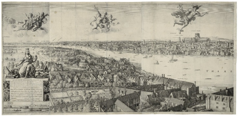
View of London, 1647, by Wenceslaus Hollar. MAP L85c no. 29. part 1. Exhibited in Open City: London, 1500–1700.
File history
Click on a date/time to view the file as it appeared at that time.
| Date/Time | Thumbnail | Dimensions | User | Comment | |
|---|---|---|---|---|---|
| current | 11:52, 13 July 2015 | | 1,536 × 755 (397 KB) | SophieByvik (talk | contribs) | View of London, 1647, by Wenceslaus Hollar. MAP L85c no. 29. part 1. Exhibited in ''Open City: London, 1500–1700''. |
You cannot overwrite this file.
File usage
The following 2 pages use this file: